Red Lake Mining District
- Over 30 million ounces of gold produced to date
- Almost 100 years of gold production, discovered 1925.
- Premium gold grade, historic average of +16 gram gold per tonne.
- US $54 billion in value of gold mined (source Pure Gold)
- Deep seated, robust gold system, gold mineralization from surface to depths of 3 kilometers.
- Currently 2 producing gold mines.
- One of the most active exploration districts in North America, lead by high-profile gold explorer Great Bear Resources (TSX-V: GBR)

A History of High-Grade Gold
Gold was discovered on the shores of Red Lake by L.B. Howey in 1925. Word spread quickly and the town experienced a sudden surge in economic, industrial, and population growth. People travelled by dog team, on foot, or by open cockpit airplanes to seek their fortune.
By 1936, Red Lake’s Howey Bay was the busiest airport in the world, with more flights taking off and landing per hour than any other.
Since 1925, there have been 28 operating mines and 28 million oz of gold produced at Red Lake. The majority has come from four mines: Red Lake (Dickenson), Campbell, Madsen, and Cochenour.
Location
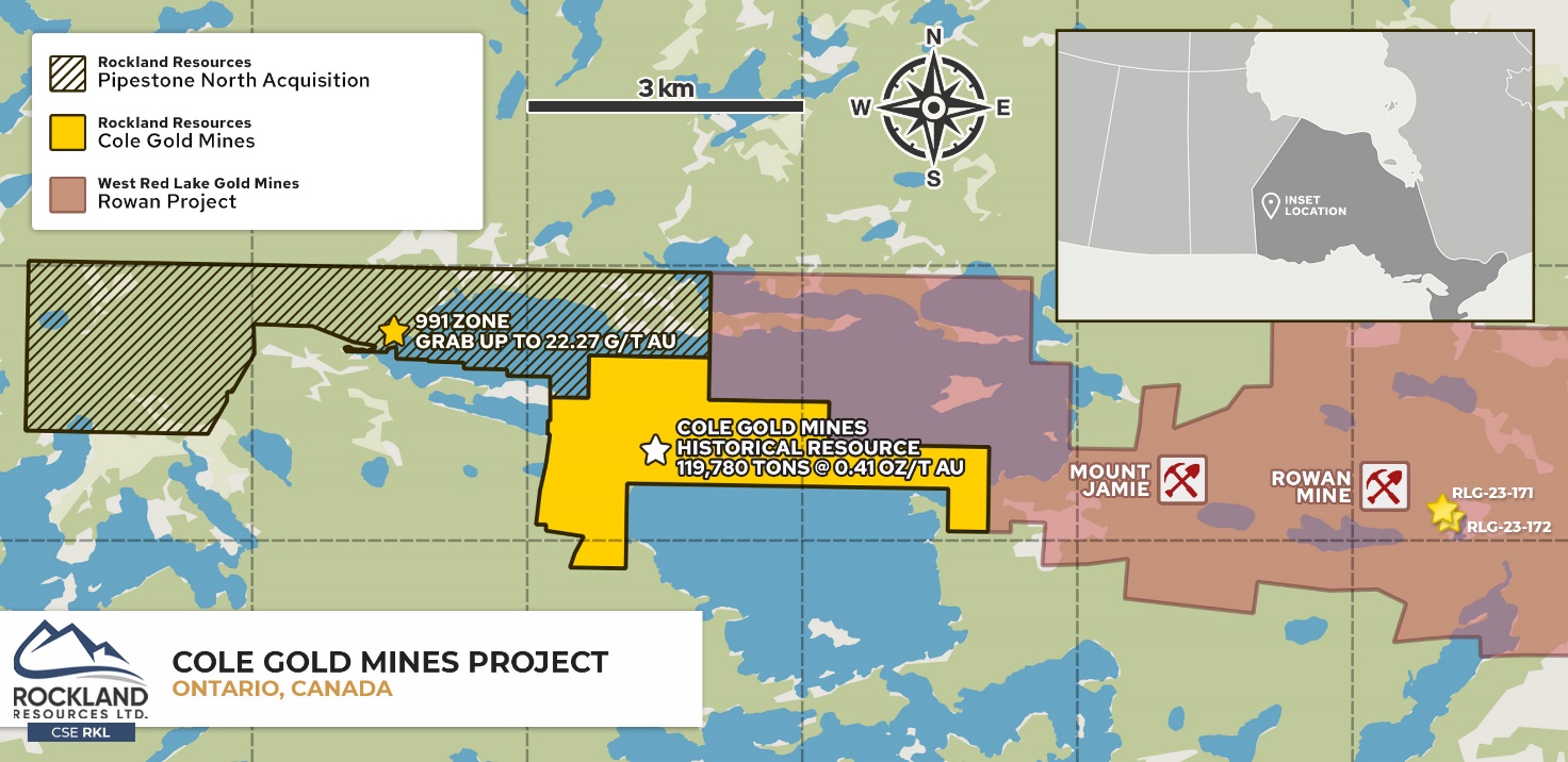
The Cole Gold Mines property consists of 28 claims totaling 568 ha located in the prolific Red Lake Mining District, accessible by road from the town of Red Lake. The property is 30 km west of the Cochenour, Campbell, Red Lake Mine Complex on the Pipestone Bay Deformation Zone.
Geology
The property is comprised of felsic metavolcanic rocks and quartz porphyry intruded by gabbro sills. Shear zones in the porphyry and felsic rocks strike east-west, dip steeply north and contain gold mineralized quartz veins. High-grade gold is associated with sphalerite-chalcopyrite-scheelite bearing quartz veins.
Exploration History
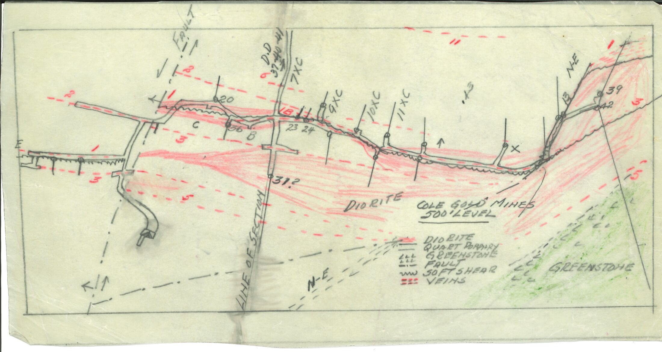
Cole Gold Mines Ltd. developed an exploration shaft to a depth of 530 feet with underground development on 4 levels in the 1930’s.
Historical exploration found high-grade gold intersections up to 2.2 oz/t Au over 1.5 feet in sulphide mineralized quartz veins in sheared quartz porphyry drilled by Kerr Addison Mines. A historical longitudinal section resource estimate of 119,780 tons at 0.41 oz/t Au*.
*These historical estimates do not meet current standards as defined by NI 43-101 and therefore should not be relied upon.

New Historical Data
In March 2024 a deep dive into public historical records found data from a drill hole completed in the 1930’s, among other occurrences still being processed, from a separate area than where past underground exploration had occurred. Hole DDH-12, drilled by Cole Gold Mines and located approximately 450 meters southwest from the historical underground workings, intersected over 3.5 meters of vein quartz in schist with gold values in quartz and visible gold in the fractures. This surface hole was drilled to the southeast at a -60 dip, and is very shallow, at only 39 meters in depth, with the intercept approximately halfway down the hole.
The importance of this drill hole was noted in a 1953 report* by Wilfred P. Mackle, Mining Engineer, when describing an interpreted fold located southwest of the mine shaft area, with an axis striking northeast: “It is along the axis of this fold that the ore bodies located occur and a further significant feature is provided by DDH-12 from surface which indicated the possibility of a major ore occurrence striking parallel to the fold axis as opposed to the ore bodies in the shaft area which strike roughly east-west. I rather emphasize the importance of this fold pattern because it is a very important feature of the Cochenour-Campbell-Dickenson ore deposits, and probably also with the Madsen area, and the conclusive evidence of a major fold occurring in the proximity of the presently known ore bodies is, in my opinion, of major significance.”
Limited drilling by Rockland in 2021, cut short by forest fires in the region, did not test this intercept or the vicinity at all, as it was not known due to government restrictions of in-person access to the local Red Lake-Ontario Geological Survey archives during COVID.
“The above underground development was productive in opening up a total length of 2030 lineal feet of ore with a possible grade of 0.452 oz. across a width of 45 inches. From observations of the surface ore exposures and a study of the underground assay plans, I am of the opinion that systematic test holing and subsequent slashing of the drift walls would increase the widths considerably and with little or no drop in the grade averages. The values are not confined to a ribbon like vein structure but in zones of silicification and narrow lenticular quartz veins, more or less en echelon, and with the exception of a few cross cuts and some widespread slashing of the drift walls, I do not feel that all the width possibilities have been determined.”
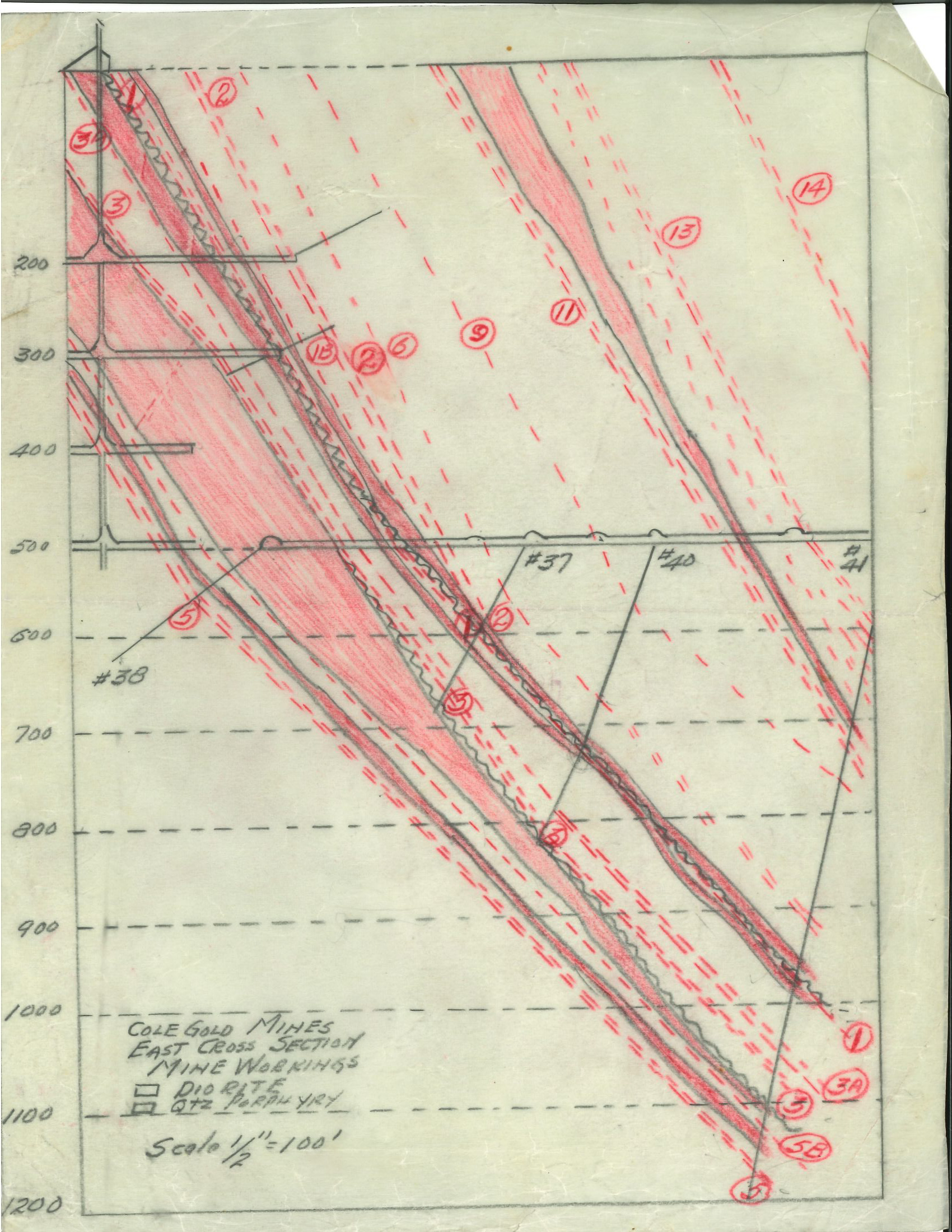
In the conclusion of the report, when describing this underground development, the author states: “The many parallel gold bearing zones is, in the opinion of the writer, a most important feature. As shown on the cross section there are nine (9) gold bearing zones indicated across a horizontal width of 750 feet. On surface there are as many more and all warrant attention”.
Rockland continues to compile historical geophysical and geological data over the Pipestone North property in preparation of a summer field program, in conjunction with the Cole Gold Mines property.

